Embark on your next adventure with our comprehensive guide to hiking, cycling, skiing, and exploring the Alps, whether by car or public transport. Our app is your ultimate companion for planning and enjoying outdoor activities around the globe.
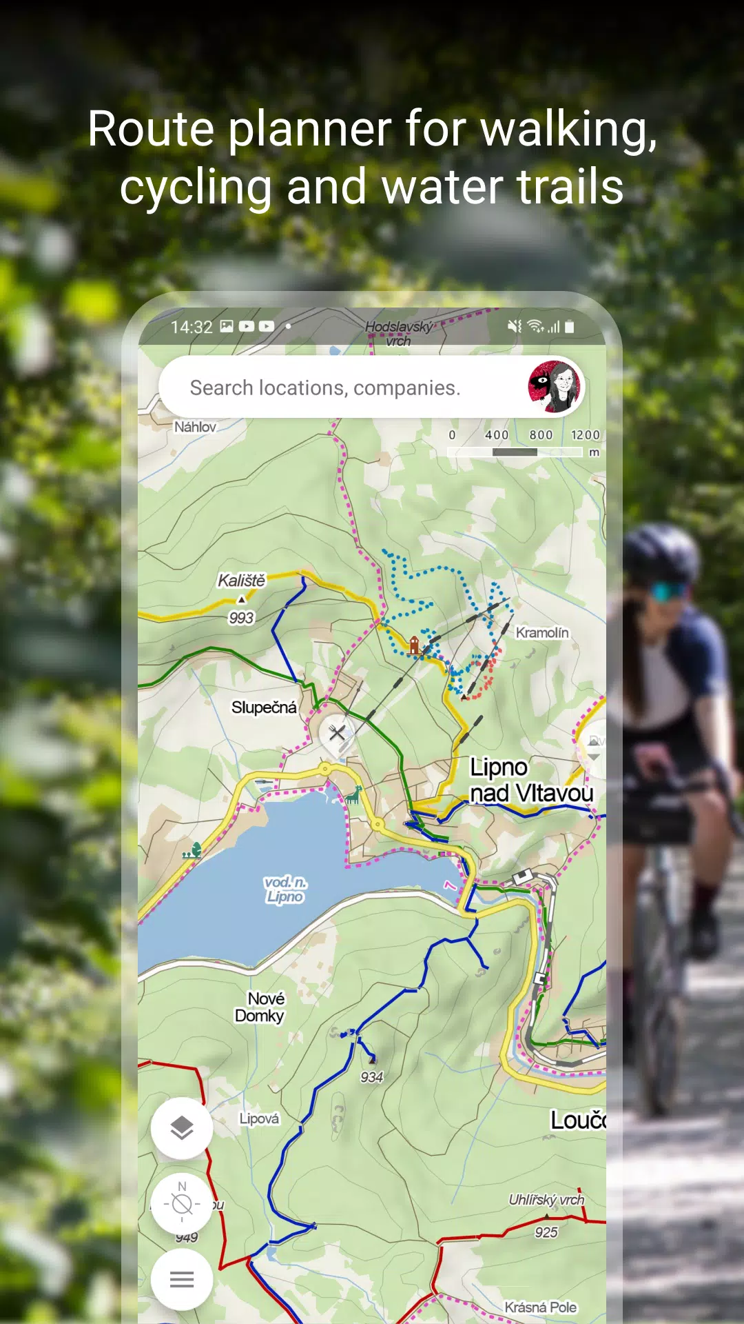
Plan Your Route
Discover the perfect paths for your adventures:
- Hiking and Cycling Trails: Navigate through scenic routes tailored for walkers and cyclists.
- Cross-Country Skiing and Ski-Alpine Trails: Find the best spots for winter sports enthusiasts.
- Unique "Travel Tips" Feature: Let our app plan a trip that takes you through the most intriguing spots in any area.
- Route Elevation Profile: Understand the terrain with detailed elevation data.
- 5-Day Weather Forecast: Stay informed with temperature, wind, and precipitation forecasts for any location worldwide.
Browse the Tourist Map of the Whole World
Explore the world with detailed maps:
- Trails and Paths: Marked hiking trails, bike trails, singletracks, and footpaths.
- Detailed Terrain Information: Hillshade views and ferrata markings with difficulty levels.
- Accessibility: Routes designed for wheelchair users and educational trails.
- Regulations and Zones: Pedestrian closures and national park zones clearly indicated.
Switch to Other Map Layers
Enhance your map experience with various layers:
- Aerial and Panoramic Views: Aerial maps of the world and panoramic images of Czech streets with 3D views.
- Winter Sports: Up-to-date winter maps showing cross-country ski trails and ski resorts.
- Traffic Information: Real-time traffic, road closures, and parking zones specifically for the Czech Republic.
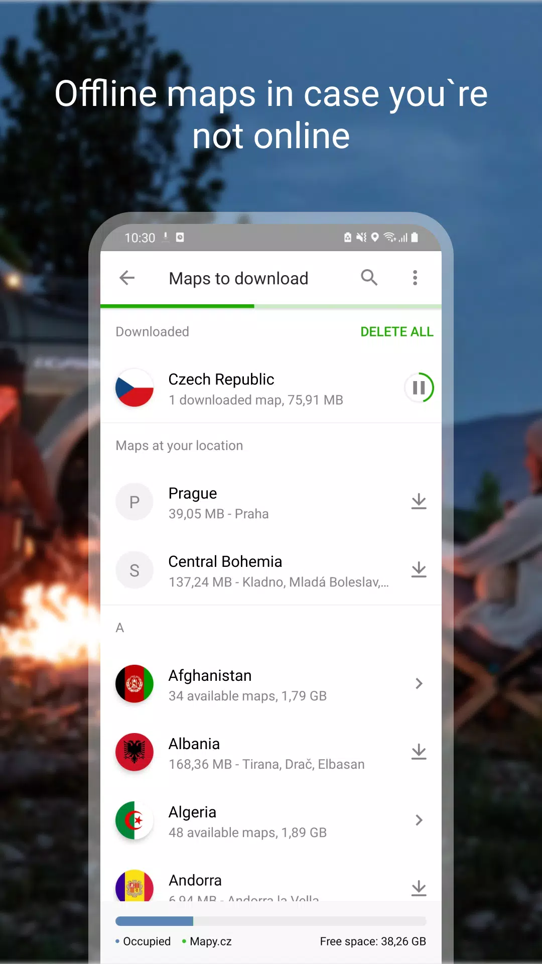
Download Offline Maps
Prepare for your journey with offline capabilities:
- Worldwide Offline Access: Tourist maps with hiking and cycling trails available offline.
- Voice Navigation: Offline navigation for drivers, cyclists, and pedestrians.
- Winter Maps for the Czech Republic: Detailed maps for cross-country skiing and ski resorts.
- Flexible Downloads: Download individual regions and navigate without a signal.
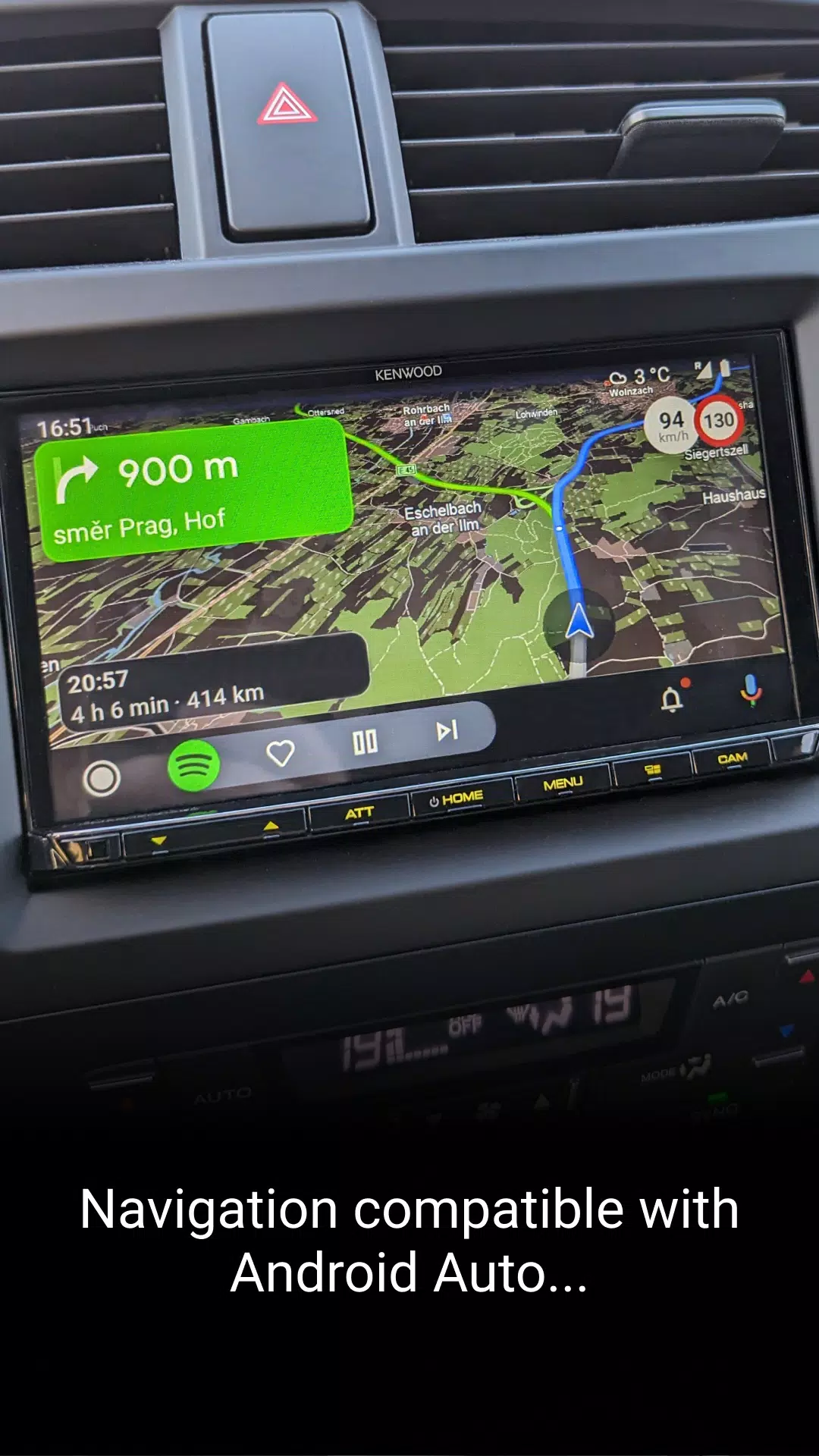
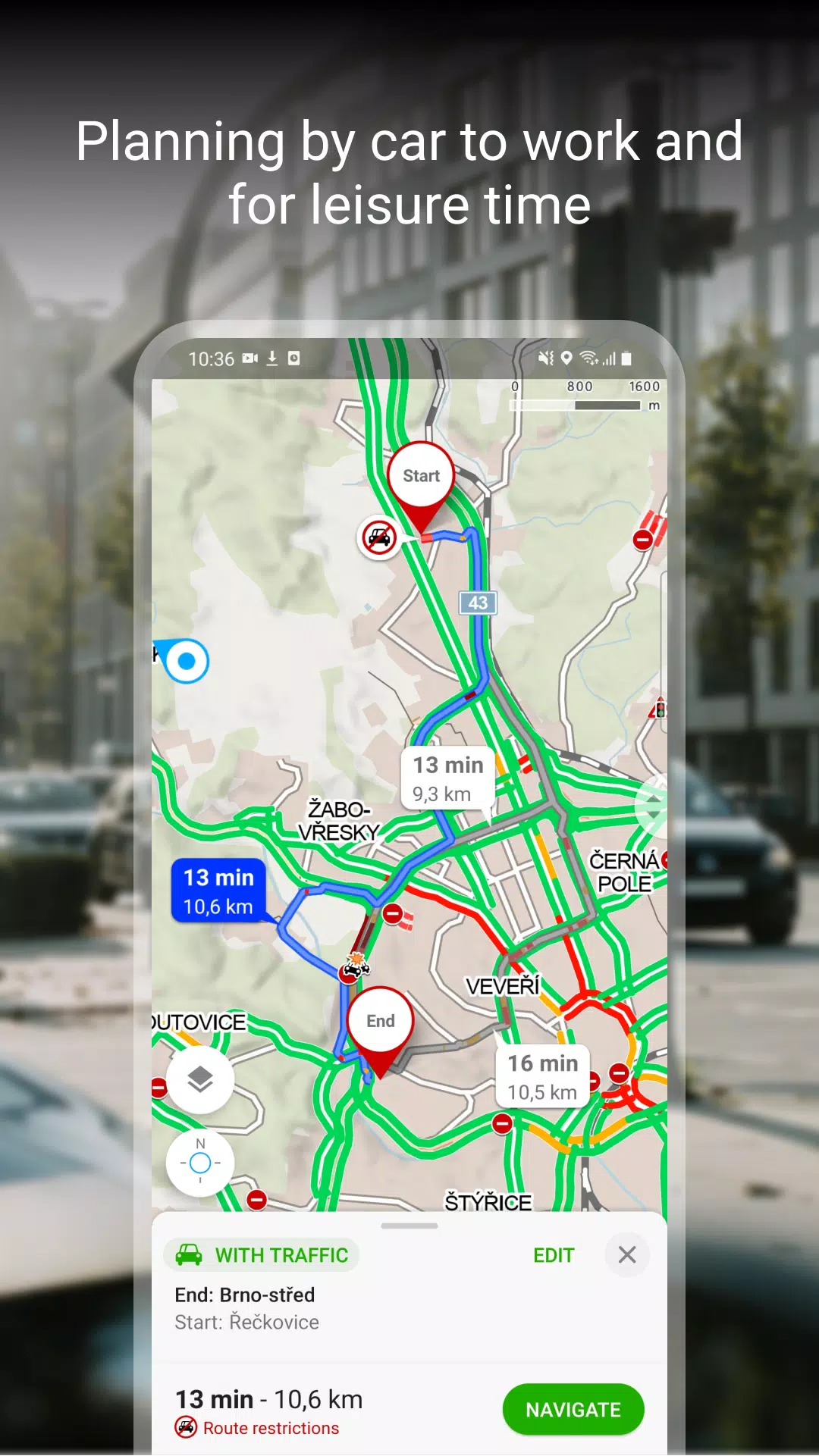
Free Navigation for Drivers, Cyclists, and Pedestrians
Navigate with ease and precision:
- Detailed Instructions: Clear lane guidance and roundabout exit highlights.
- Customizable Routes: Ability to avoid toll lanes.
- Enhanced User Experience: Dark mode and sharing options for arrival times and locations.
- Integration with Car Systems: Compatible with Android Auto and Apple CarPlay for larger displays.
- Safety and Alerts: Speeding alerts, speed cameras, and real-time traffic information for the Czech Republic.
Save to My Maps
Organize and track your adventures:
- Personalized Storage: Save places, routes, photos, and activities in organized folders.
- Activity Tracking: Use Tracker for various activities like walking, cycling, running, and skiing.
- GPX Compatibility: Import and export GPX files for seamless route planning.
- Cross-Device Sync: Synchronize your planned routes across different devices.
Choose by Reviews of Places, Restaurants, and Services
Make informed decisions with user reviews:
- Visual Insights: Up-to-date user photos of locations.
- Detailed Feedback: Reviews on food, service, ambiance, and pricing.
- Search and Filter: Find top-rated establishments easily.
Recommendations and Tips
Ensure a smooth experience with these tips:
- Internet Connection: Required for downloading maps.
- Location Services: Enable for optimal app functionality.
- Background Location Access: Necessary for location sharing features.
- Support and Feedback: Use the in-app form for questions or troubleshooting.
- Battery Life: Be aware that using the app in the background with GPS can drain your battery.
- Community Engagement: Join our user community at www.facebook.com/Mapy.cz/ to share experiences, stay updated, and suggest new features.