MAPinr offers seamless management of KML/KMZ/GPX files, making it a versatile GIS tool for professionals and enthusiasts alike. Whether you're into hiking, cycling, running, or skiing, MAPinr is your go-to app for handling geographic data. With features like measuring distances and areas, GPS logging, and support for Web Map Service (WMS), you can take your mapping experience to the next level. Plus, enjoy the convenience of offline maps for those off-the-grid adventures.
Thank you for choosing Mapinr. As Android versions evolve rapidly, sustaining a non-profit project like ours becomes increasingly challenging. However, we remain committed to our mission of delivering a secure, privacy-focused, and affordable app.
We understand that some devices may not meet the minimum Android version required by G. To ensure everyone can use MAPinr, we provide downloads for older Android versions (below Android 14) on our website, which are no longer available on the Play Store.
Do you need to manage your personal points of interest or want to place your photos on a map? MAPinr is the simple, ad-free Android app you need. It allows you to efficiently manage your KML/KMZ files and visualize your GPX files on various maps.
Your feedback is invaluable to us. Please share your issues and suggestions for improving MAPinr by emailing [email protected]. We appreciate constructive feedback and understand the frustrations that can come with software bugs. We kindly ask for your patience, as our limited resources mean we can't implement every suggestion.
MAPinr offers a comprehensive set of features:
- Ad-Free Experience: Enjoy a clutter-free interface with no ads.
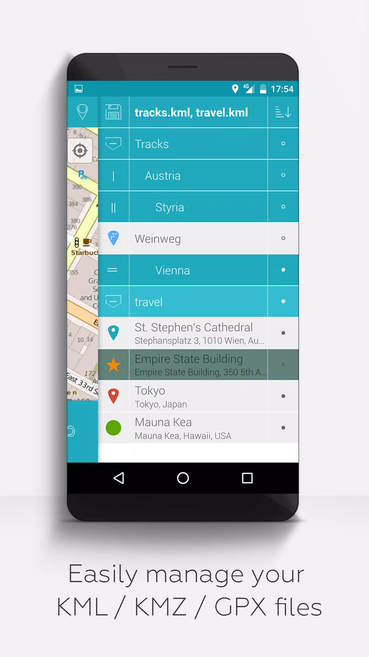
- Organized File Management: Utilize a hierarchical folder structure for managing multiple KML/KMZ/GPX files.
- Comprehensive File Operations: Create, load, edit, save, import, export, and share KML/KMZ files.
- Versatile Data Handling: Create, load, edit, save, import, export, and share waypoints, lines/tracks, and polygons.
- Photomaps: Add pictures to your waypoints to create personalized photomaps.
- Multi-Map Support: Display waypoints, lines/tracks, and polygons on various maps, including Maps, Satellite, Hybrid, OpenStreetMap, Opentopomap, and Opencyclemap.
- Coordinate Sharing: Easily share the coordinates of your waypoints.
- Customizable Visuals: Individually colorize waypoints, lines/tracks, and polygons for better visibility.
- Interoperability: Open exported KML/KMZ files in other apps.
- Advanced Search: Search by name, address, and coordinates.
- Location Sharing: Share your location with friends.
- Simultaneous Display: View multiple KML/KMZ/GPX files at the same time.
- File Merging: Merge KML/KMZ files for streamlined management.
- Cloud Integration: Seamlessly integrate with cloud services.
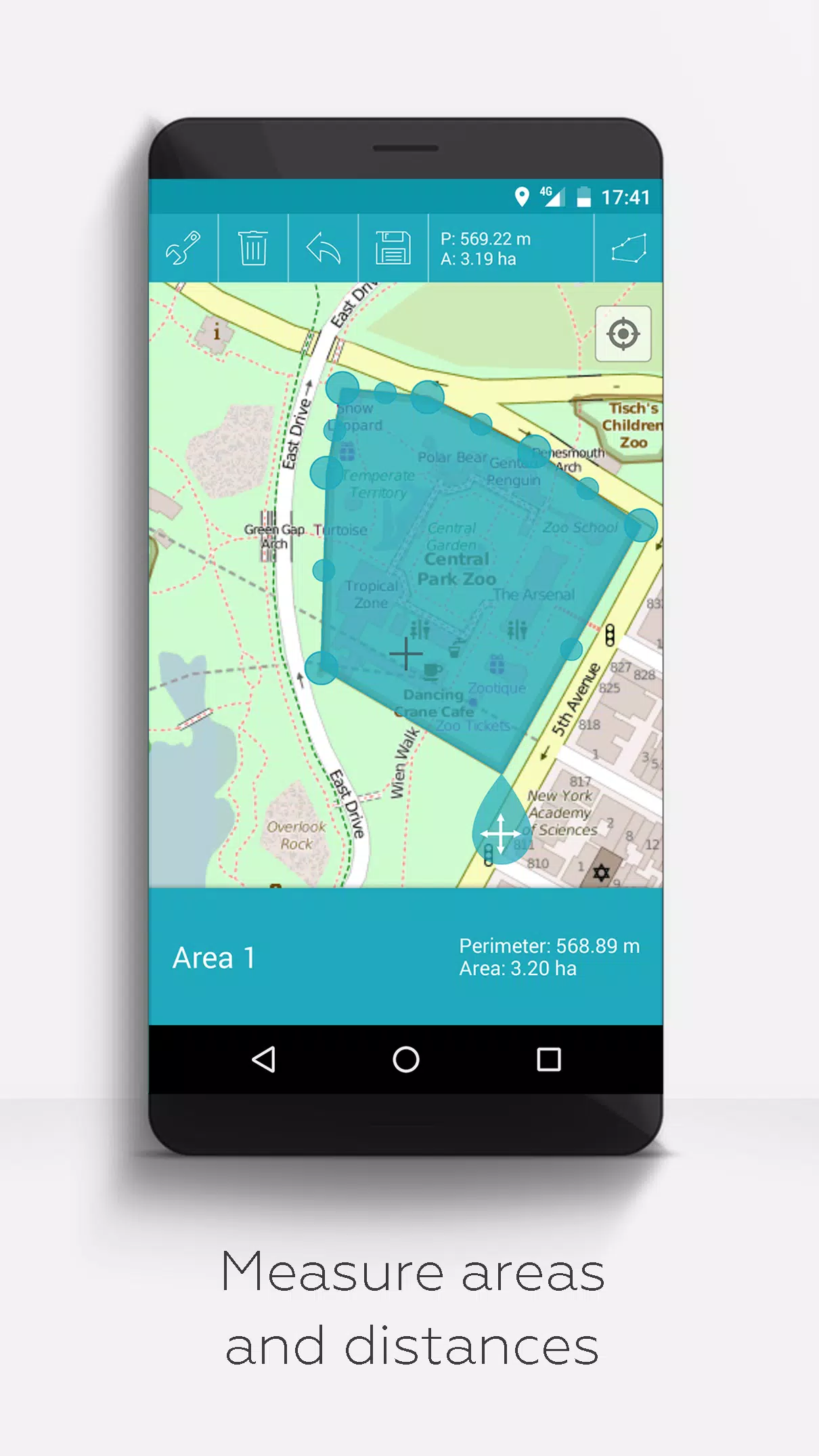
- Measurement Tools: Measure distances and areas directly on your map.
- Multilingual Support: Currently available in English, Spanish, Lithuanian, and Polish.
Extended features are available for free with donations or by liking us on LinkedIn; activate them in the Settings:
- Offline Maps: Download OpenStreetMap for offline use.
- GPX Viewer: Display GPX files (view-only).
- WMS Support: Display arbitrary map data using Web Map Service, such as Opendata from www.data.gov.
- Custom Metadata: Create custom metadata for your files.
- Custom Icons: Upload and use your own icons.
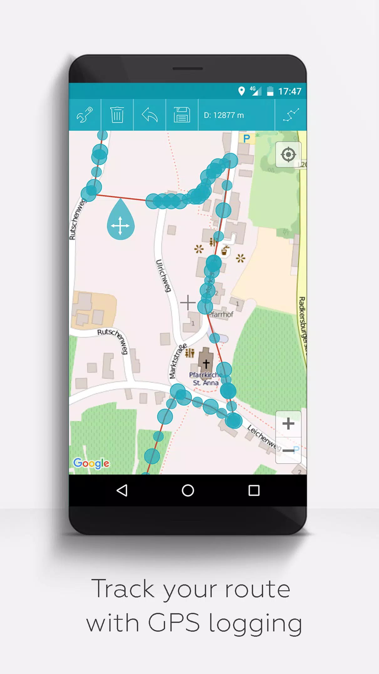
- GPS Logging: Record your GPS tracks.
Unlike other apps, MAPinr respects your privacy and does not collect or sell your data. Donations are a voluntary contribution to support our non-profit efforts.