OfflineMaps provides you with an extensive selection of maps that you can access anytime, anywhere! With OfflineMaps, you can enjoy your mapping experience without any interruptions:
- **No advertisements** - Enjoy a clean, focused map viewing experience.
- **No data sharing & monetization** - Your privacy is our priority; we don’t share or monetize your data.
- **No analytics** - We respect your privacy and do not track your usage.
- **No third-party libraries** - A streamlined, secure experience without external dependencies.
Tired of waiting for maps to load? With All-In-One OfflineMaps, once a map is displayed, it's stored for quick access, even without an internet connection. This means you can:
- **Explore beyond just roads** - Discover a variety of map types tailored to your needs.
- **Navigate in areas with poor network coverage** - Your maps remain available, ensuring you're never lost.
- **Travel abroad with confidence** - No more worries about getting lost in unfamiliar territories.
- **Conserve your data allowance** - Reduce data usage by relying on offline maps.
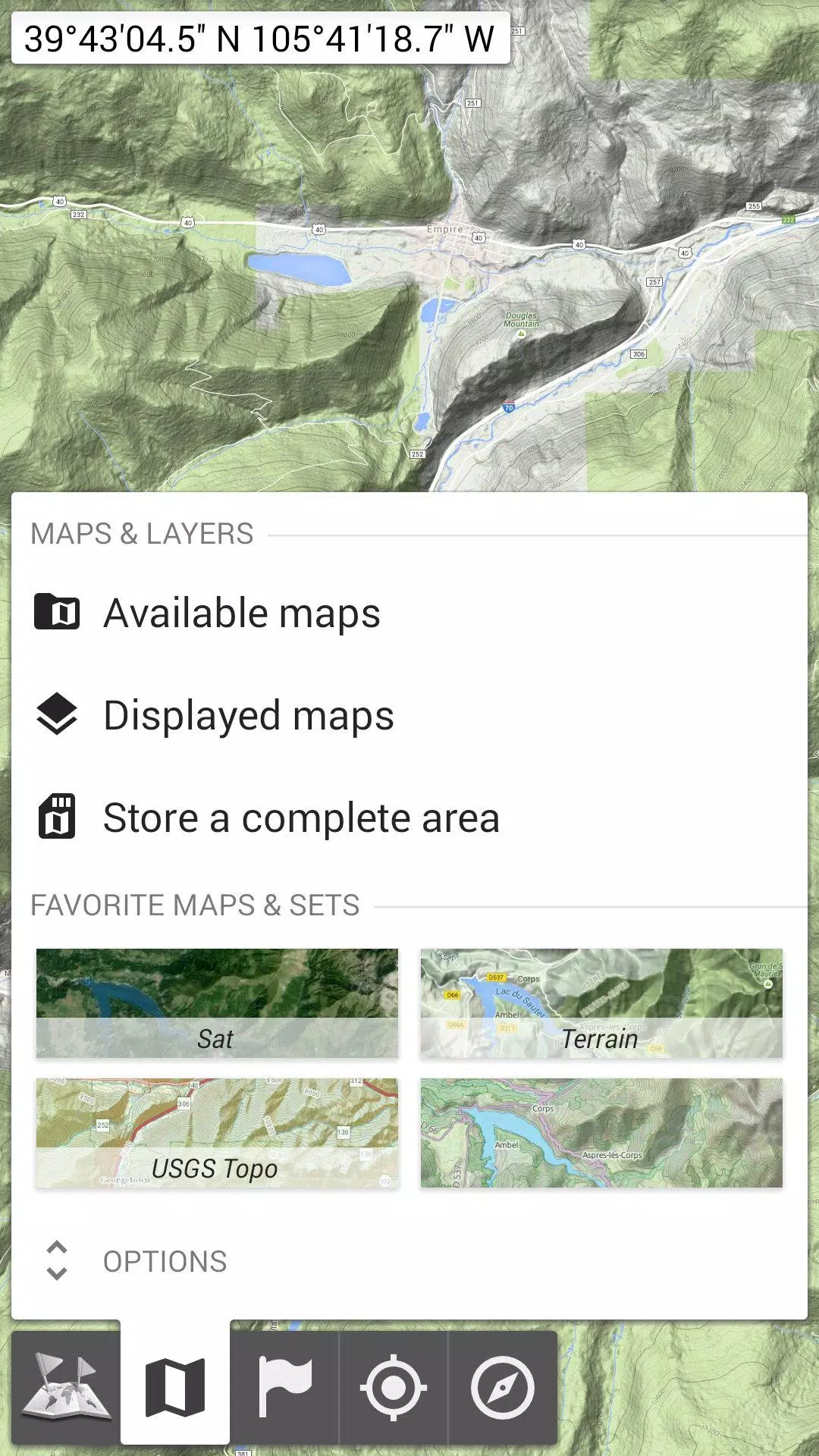
★★ Maps ★★
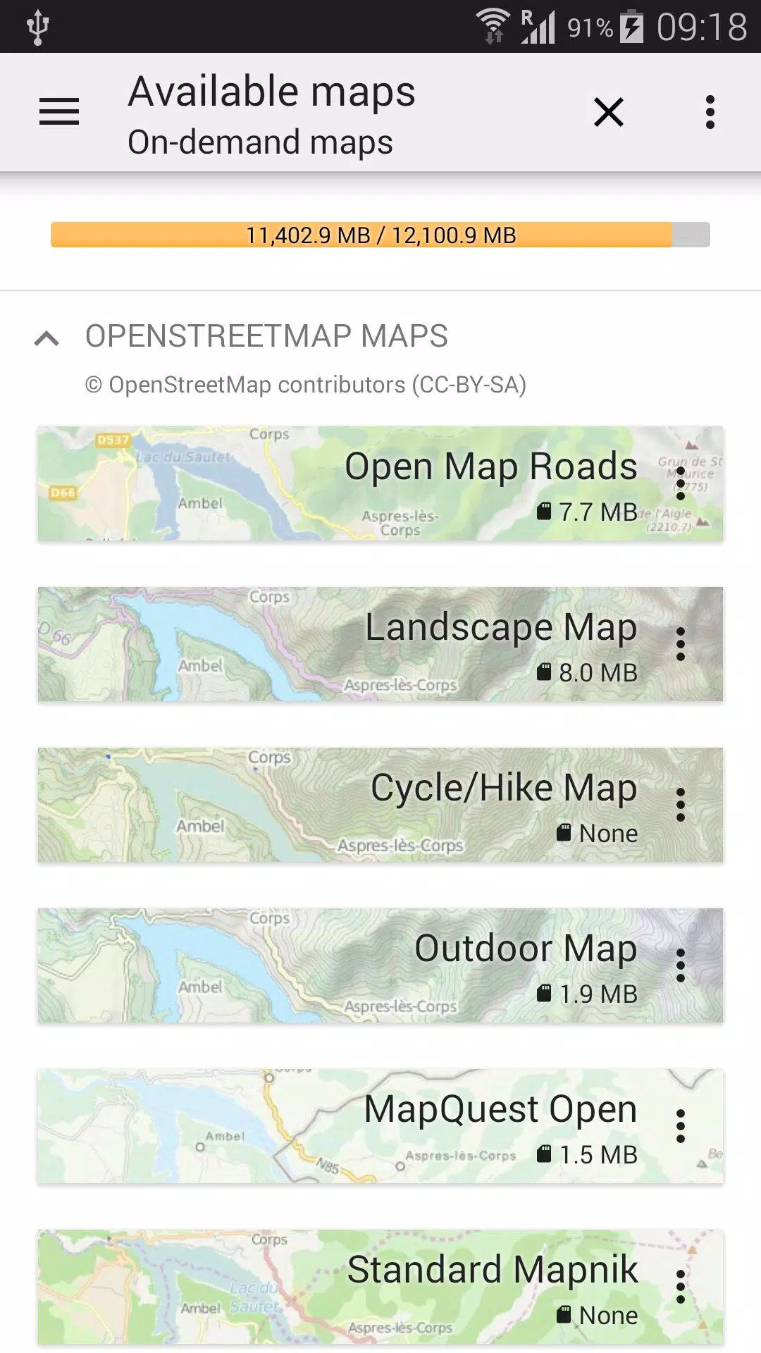
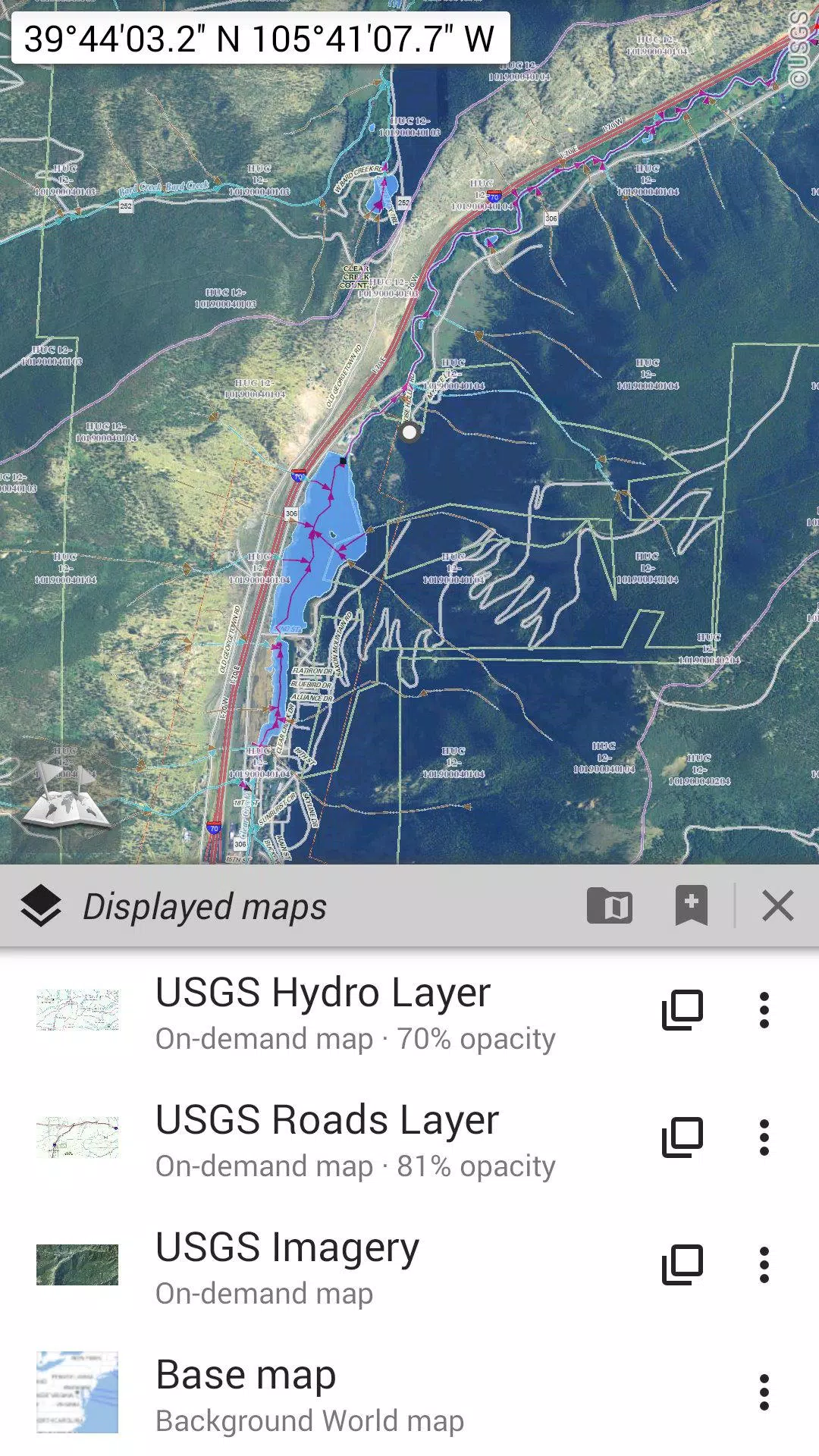
OfflineMaps offers a diverse array of maps, from classic road maps and topographic maps to aerial (satellite) imagery. You can also enhance your maps with additional layers such as:
- OpenStreetMap (Roads, Topo)
- USGS National Map (Hi-res topo, Aerial imagery)
- Worldwide Military Soviet topo maps
These maps can be layered with precise opacity control, allowing you to select and store large areas with ease. Managing your stored maps is straightforward, with clear space indicators and simple deletion options.
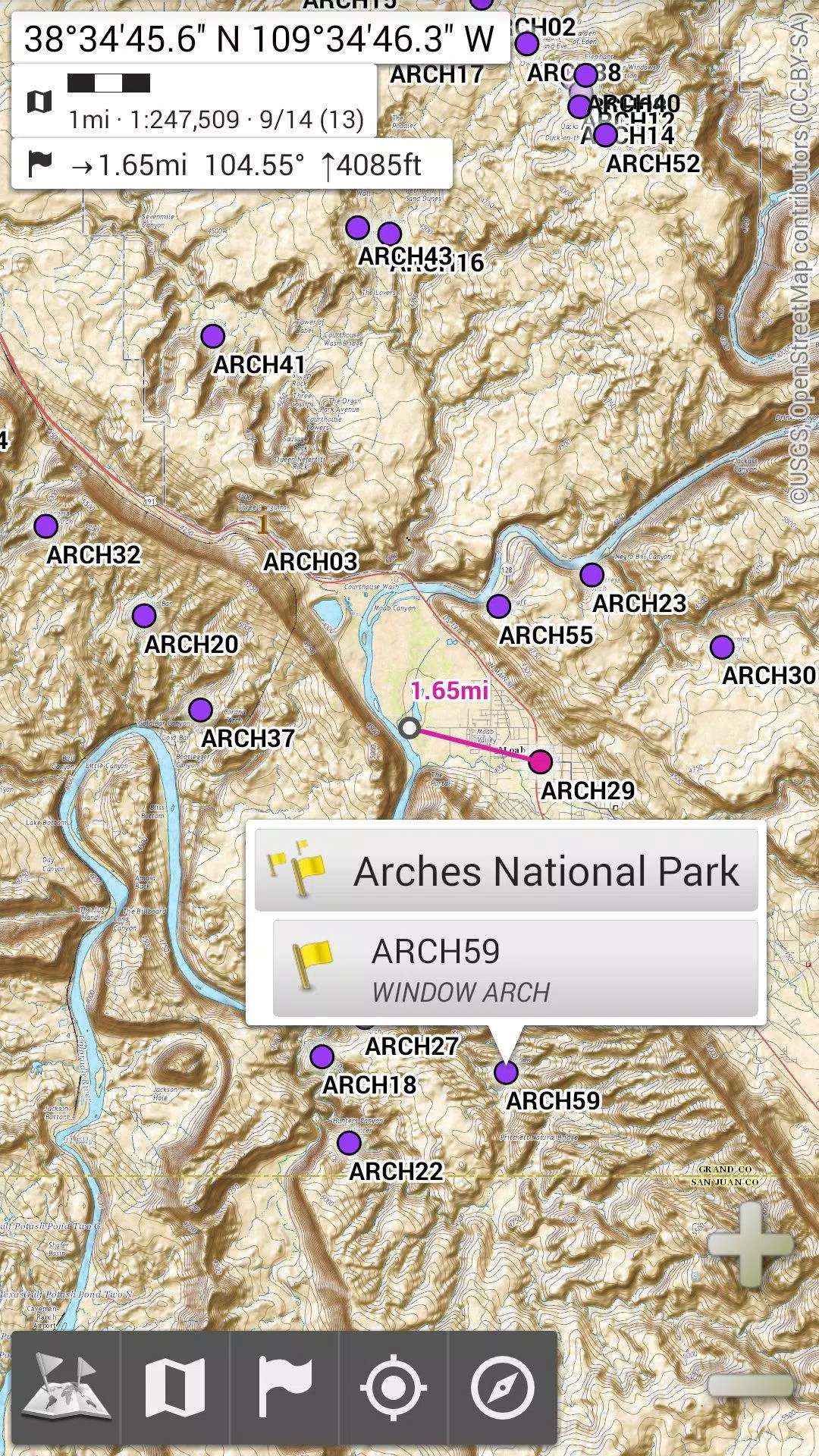
★★ Display, Store, and Retrieve Unlimited Placemarks ★★
Customize your maps by adding various items such as waypoints, icons, routes, areas, and tracks. Manage these effortlessly with the powerful SD-Card Placemarks Explorer, giving you complete control over your map data.
★★ On-map GPS Location & Orientation ★★
Your real-time location and direction are clearly displayed on the map, which can be rotated to align with your actual orientation, depending on your device's capabilities. Easily toggle this feature on and off to save battery life.
Additional features include:
- Metric, imperial, and hybrid distance units for accurate measurements.
- Support for various GPS coordinate formats such as Latitude/Longitude, UTM, MGRS, USNG, OSGB Grid, Irish Grid, Swiss Grid, Lambert Grids, DFCI Grid, and QTH Maidenhead Locator System.
- The ability to import numerous coordinate formats from spatialreference.org.
- On-map grid display for enhanced navigation.
- Full-screen map view for an immersive experience.
- Multi-touch zoom for easy map navigation.
★★ Need More? ★★
For the avid adventurer, consider upgrading to **AlpineQuest Off-Road Explorer**, the comprehensive outdoor solution built on the foundation of All-In-One OfflineMaps. It comes equipped with a powerful GPS Track Recorder and much more. Learn about this advanced tool at alpinequest.net/google-play.